
One of the unique parts of Gimli is its breakwater.
We’re not talking here about the Main pier. We’re talking about the paved strip of path from South Beach north to town, one of the treasures we locals love.

Its history is stitched with layers of municipal politics and weather events.
It has been a fixture since at least 1956.

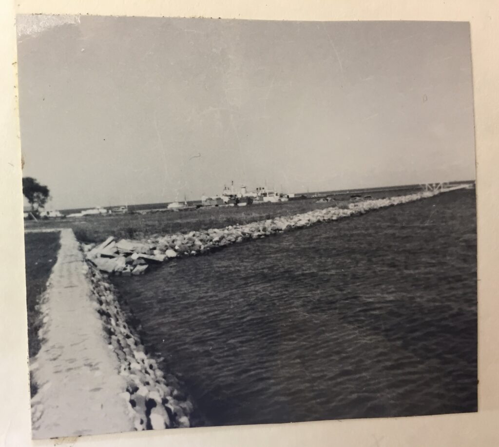
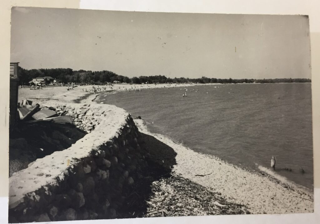
Following the curve of the shoreline along the south basin of the Gimli harbour.

The seawall and the Viking seem to go hand in hand, inextricably tied.
Its creation was a Gimli Chamber of Commerce centennial project. Designed by Gissur Eliasson of the University of Manitoba, it was constructed by George Barone, the creator of other Manitoba statues, at a cost of $15,000. It was unveiled in 1967 by then-President of Iceland Asgeir Asgeirsson. The finished statue is 4.6 meters or 15 feet tall, constructed entirely of fiberglass.


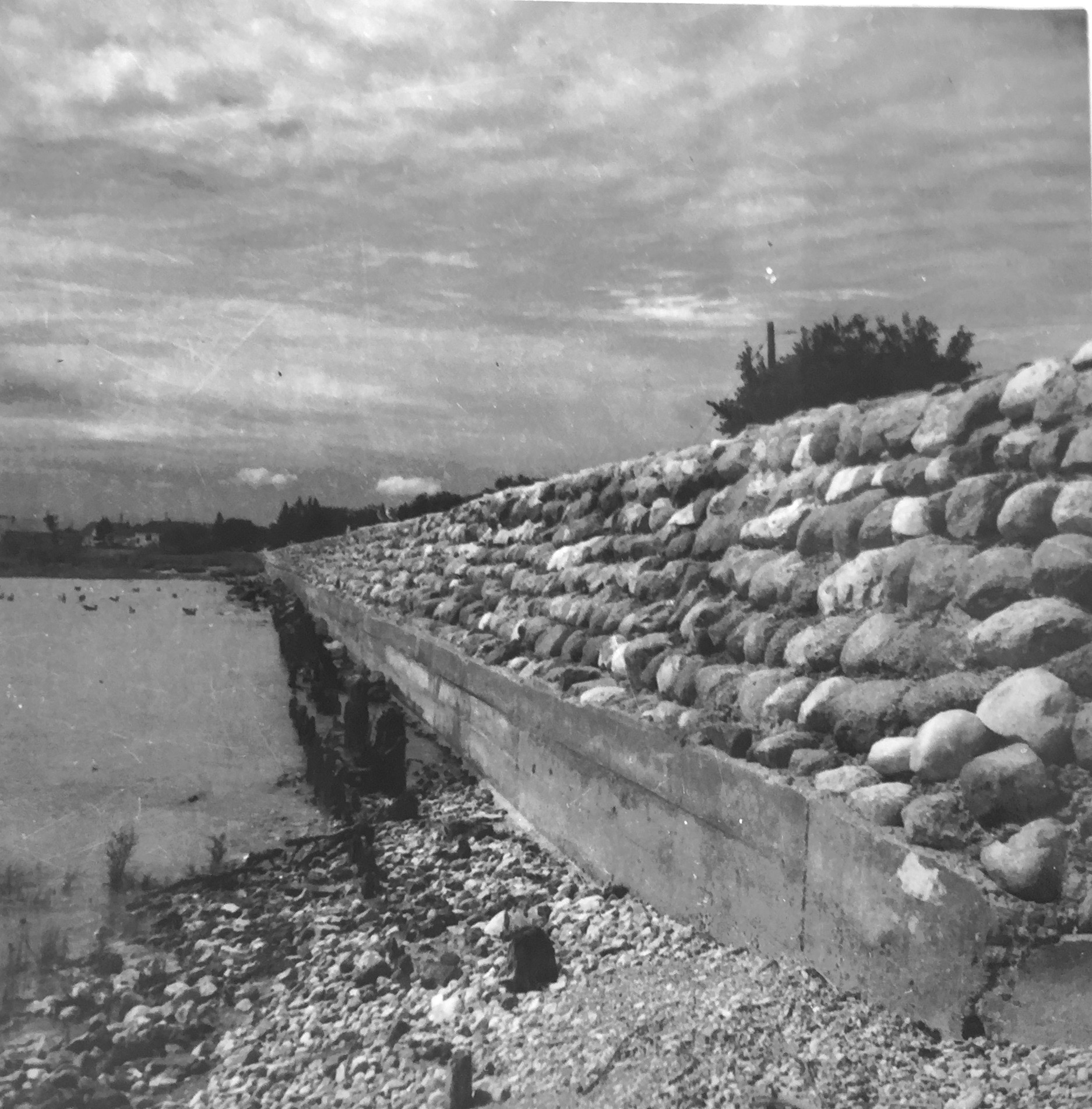
Historically the breakwater was a dike, paid for by the Federal Government who bequeathed it to the town to maintain in perpetuity.
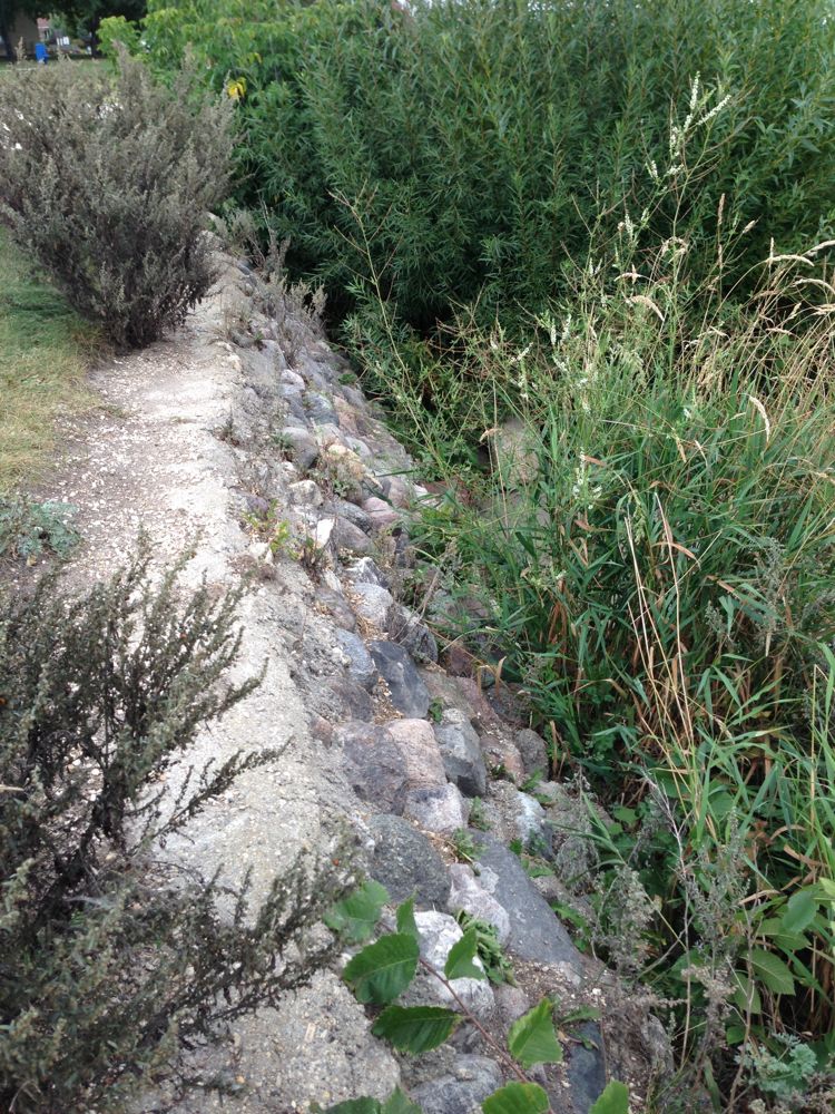


This historic section, in front of Betel Home, is one of the only remaining parts of the old wall.
The Gimli Town Council wanted to upgrade the waterfront as part of a master plan. With various twists and turns, including land agreements, harbour improvements, street surveying, and preparations to host the Pan American Games the breakwater remained forever intertwined like a thread holding together an old quilt.
When the Betel Home was rebuilt, it necessitated the moving of the Viking statue. Originally Town Council was hoping to move the statue to the little jetty of land where the New Iceland heritage plaque sits. But this would have meant rerouting of streets and major public discussion. The Viking was moved instead to a little triangular lot which became town property.

In preparation for the Pan Am Games Sailing venue in 1999, they finished dredging the harbour to a 12 foot depth and subsequently built a hill with the dredgate (affectionately referred to as “Bill’s Hill” after then mayor, William Barlow) to the south of Betel. The dredgate was so wet that it took a long time for the hill to settle.

Thankfully the town left the old breakwater exposed. It still shows through the grass and is still used as a bike path.
Feels like our own little ribbon of Hadrian’s Wall.
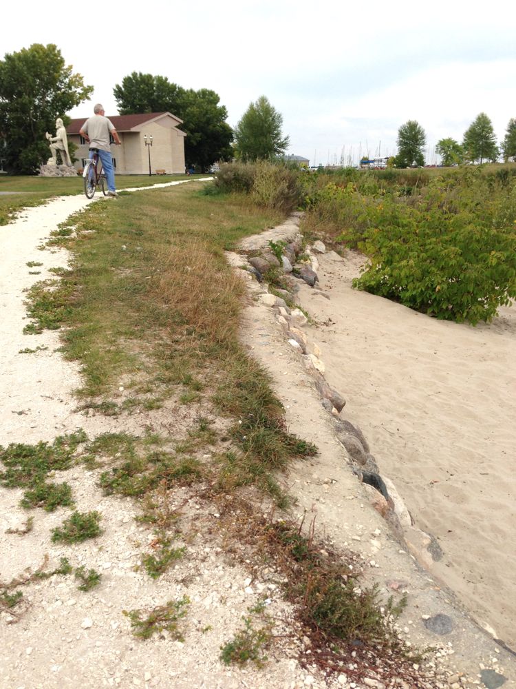
The original ‘dike’ was so skinny, you would never think of actually walking on it for fear of falling in the lake.
Sometime between 1956 and the 1970s the wall was widened to about 4-5 feet across and paved, covering up most of the original architecture.


During the high water events of 2006-2007 and subsequent Provincial government diking fiasco, the wall was backfilled and had to be shorn up against a wooden parapet.

It does remain somewhat of a bastion of defence against the 3-day Autumn storms.


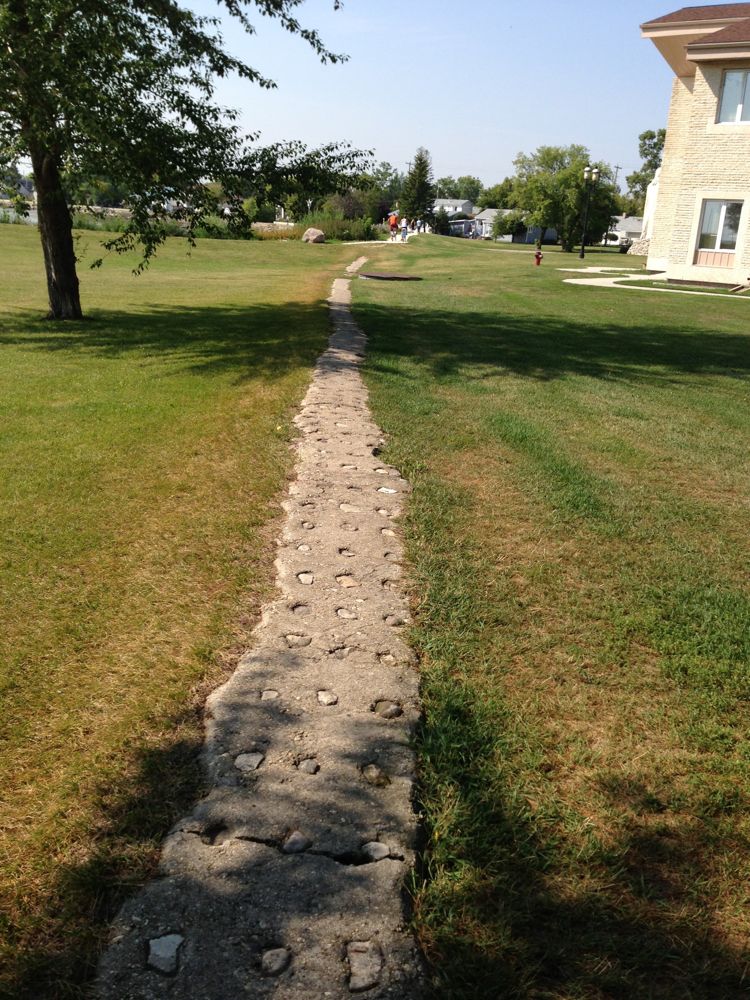
Major cracks have developed this year making it almost treacherous for cyclists and joggers.

Even though this year the Town paved the part of the path which bridges the south culvert (or what we used to call the Municipal Ditch), nothing has been done to maintain the southernly-most portion into South Beach.

In the 1960s the breakwater stretched all the way to Morkill Street, if memory serves.


Over the years the breakwater has been upgraded, but never maintained as the most beautiful scenic footpath from South Beach and the tourist-drawing treasure which it could be.
2013 SEPTEMBER UPDATE!!!!!!
Perhaps it was due to this blog post that the Council saw fit to repair the breakwater!

(This article was originally published in 2013 under the title The Gimli Seawall.)
Submitted by Evelyn Ward. Thanks to Bill Barlow for filling in the gaps. All uncredited photos were from the Evergreen Library, Gimli.